Communities in the Northwest Territories are preparing for another flood season as spring break-up approaches, following an historic year of flooding in 2021.
Emily King, director of public safety responsible for the Emergency Management Organization with the Department of Municipal and Community Affairs (MACA) and Nathen Richea,director of water management and monitoring with the Department of Environment and Natural Resources (ENR) held a media briefing regarding what the territorial government is doing to help communities prepare, April 12.
The GNWT has a public awareness campaign launched called ‘Be Ready’ which helps guide residents in flood-affected communities with personal preparedness, risk of flooding and disaster assistance.
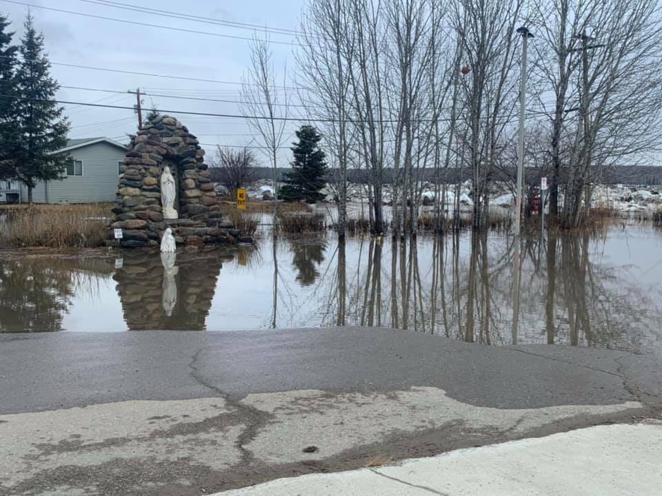
Last year, communities along the Mackenzie River, especially Jean Marie River and Fort Simpson, saw heavy flooding which forced some people to evacuate to other communities in the NWT.
MACA estimates that the cost of the flooding was about $40 million in total, though final costs are still being tallied.
The majority of floods that take place in the Northwest Territories are due to the behaviour of ice jams, however King and Richea said that the territory doesn’t have the ability to forecast floods.
With weeks away from spring-breakup season and ice moving along the water system, the risk for ice jams and floods are considered higher for some communities including Hay River and K’atlodeeche First Nation on the Hay River, Nahanni Butte and Fort Liard on the South Nahanni and Liard Rivers, and communities along the Mackenzie including Fort Simpson, Jean Marie River, Aklavik, Fort Good Hope and Tulita.
As a result, the department is doing what it can to help prepare communities and offer support with local emergency plans.
“One of the major efforts is we’ve been working together to pre identify any potential requests for assistance that may come at us ahead of flooding,” she said.
Predicting flooding
Richea said that while the territorial government doesn’t have the ability to forecast floods, ENR staff work closely with Environment and Climate Change Canada and Natural Resources Canada who have ice engineers and satellite imagery to provide the best information to MACA to act communities act.
“We use that information a lot as well as existing water levels and flow to provide advice to MACA to assist them in any emergency planning,” he said.
Richea said that the extent to which ice jams will form, where they will take shape and the extent that they will cause flooding are always different year to year.
“It’s very difficult given the dynamic nature of ice breakup,” he explained. “The temperatures that exist during the melt period, if there’s precipitation, and how much energy there is in the system all determines whether an ice jam will form.
“Or If it does form, how long it will last. It’s very difficult to model that with any certainty.”
Supplies shipped
Some supplies have already been shipped out to communities who have requested help - including cots and blankets to Fort Good Hope. Cots are also in the process of being sent to Fort Simpson.
People should be personally making efforts to be ready now if they are in flood risk areas, she said.
“Residents in the high risk areas are encouraged to develop household emergency plans to protect property and to stay informed,” she said.
“We highly recommend where possible that residents pre-identify places they can stay in the event of an evacuation, with family, friends or other arrangements.”
Her division helps emergency responses with territorial government programs and services and assists with providing lodging and accommodations for when people are evacuating and need a place to stay. Among them include gymnasiums or recreational complexes.
City of Yellowknife
Last year, the City of Yellowknife, with the most of these shelter amenities in the territory, wasn’t able to provide any temporary evacuation services because of a Covid-19 public health emergency. As a result, people evacuating were sent to Fort Smith and other communities that could take them.
“This season there is no public health emergency currently and no restrictions in place,” she said. “So Yellowknife is now an option as a host community.”
Flood preparation tips for residents in flood areas
- Developing a household emergency plan
- Move equipment, vehicles, hazardous materials or belongings out of harm’s way. Elevate them up out of the the flood zone.
- Safeguard electrical and heating appliances. Turn them off if they’re not needed
- Secure or empty fuel and sewer tanks as flood risk increases
- Prepare or check home sub-pumps
- Install weather protection or sealing around any base level or low level windows and doors.
- Contact insurance company and investigate and understand flood related policies
- Follow advice in MACA flood preparation campaign
- Stay in touch with community government