Researchers are setting up shop in Tuktoyaktuk to monitor a nearby island that is literally crumbling into the sea as Arctic temperatures warm.
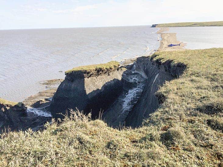
Last week, Natural Resources Canada researchers, led by Dustin Whalen, began a three-week operation that will involve drones flying over Pelly Island to map out where, and how fast, the cliffs that line its shores are splintering off into the Beaufort Sea.
In addition to being part of a project that will map the effects of a warming climate across Canadian Arctic shorelines, Whalen hopes some of the data gleaned will help Tuktoyaktuk, whose shores are eroding, plan its future.
“Tuktoyaktuk is one of the most affected communities [in terms of] climate change in our country,” says Dustin Whalen, noting nearby Tuktoyaktuk Island is also facing serious erosion.
“We’ve been to Pelly [Island] last year and the year before and we saw a lot of change,” said Whalen.
The coastline is eroding, he says, at a rate four to 10 times greater than elsewhere in the region. Parts of its coastline are fully ice, and it is largely held together with permafrost.
While coastline erosion happens all through the world as waves lap shorelines, that ice makes a difference in the Arctic.
Ice wedges form from the surface of the land downwards, and in the summer they thaw and water pools around them.
As waves collide against the cliffs on shore – a heightened occurrence, as reduced ice cover on the Arctic ocean is causing storms to last longer and be more intense – they undercut much of the land. If it weren’t for the ice holding it together, it might crumble gradually with that erosion. With warming temperatures working away at the permafrost, the ice weakens and big chunks of cliff break off along the lines of the ice wedges — some of which are 20 metres wide.
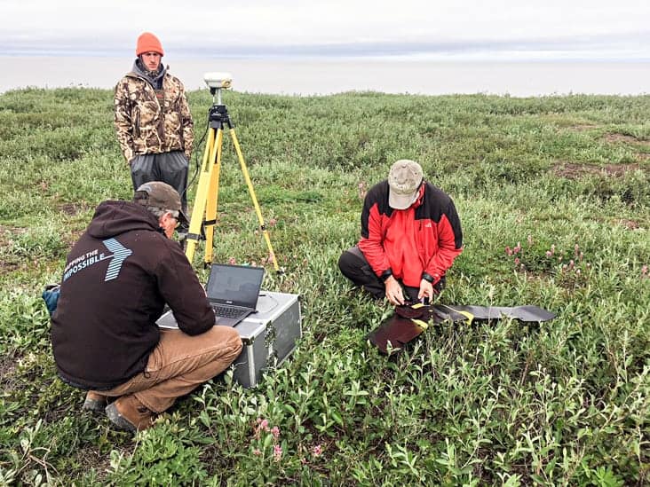
"So we have some sensors that we're going to put in, looking at how deep these ice wedge polygons go and what influence the ground ice actually has,” says Whalen. “We hope to capture one of these failures with these sensors.”
The team is also trying to study what’s in the sediments that break off. Increased cloudiness from particles in the water could threaten fish habitat, and the murkiness could also change where belugas come to shed skin.
Summer student François Malenfant, from Nova Scotia, has been in the region for the past two months conducting research and preparing for this and other ventures.
He says he’s had the chance to get involved in the community while in the North, with people taking him on a trip to a fishing camp at Shingle Point in the Yukon. He’s been learning about Inuvialuit food and culture and sharing information on the research projects he’s a part of. Community members are interested in his work, he added.
Whalen says the project has a good working relationship with Tuktoyaktuk’s municipal government as well.
Whalen says his team, along with Natural Resources Canada, hopes to produce a comprehensive piece of research on Canada’s Arctic coast in 2020, and compare it to the last report, published 20 years earlier.
“We think in all cases there's an acceleration of coastal erosion,” says Whalen.