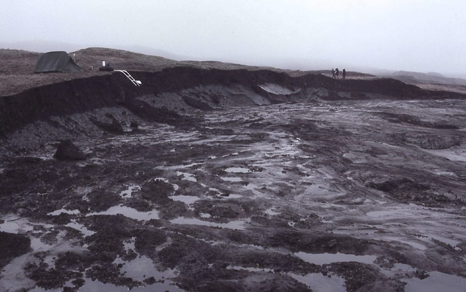
There was a 60-fold increase in landslides caused by thawing permafrost on Banks Island between 1984 and 2015, according to a research article published on April 2.

The amount of active thaw slumping—the technical term for these landslides—right now is only about 0.1 percent of the total island.
While the island can likely accommodate greater increases in activity, the 60-fold increase was caused mostly by four warm summers, which are weather events that are likely to increase as the climate warms.
“Previous work had shown there had been increases but it wasn’t at all clear when they occurred or really how much change had occurred,” says Antoni Lewkowicz, who co-authored the research paper, “Extremes of summer climate trigger thousands of thermokarst landslides in a High Arctic environment,” with Robert Way.
“So that would be where we felt that we had made a contribution—covering the whole island, covering it at high resolution, and high temporal resolution, which is [imagery from] basically every year.”
Most of the thaw slumps have taken place along the eastern and southern shores of Banks Island, with some taking place in Aulavik National Park and less taking place in the Banks Island Migratory Bird Sanctuary.
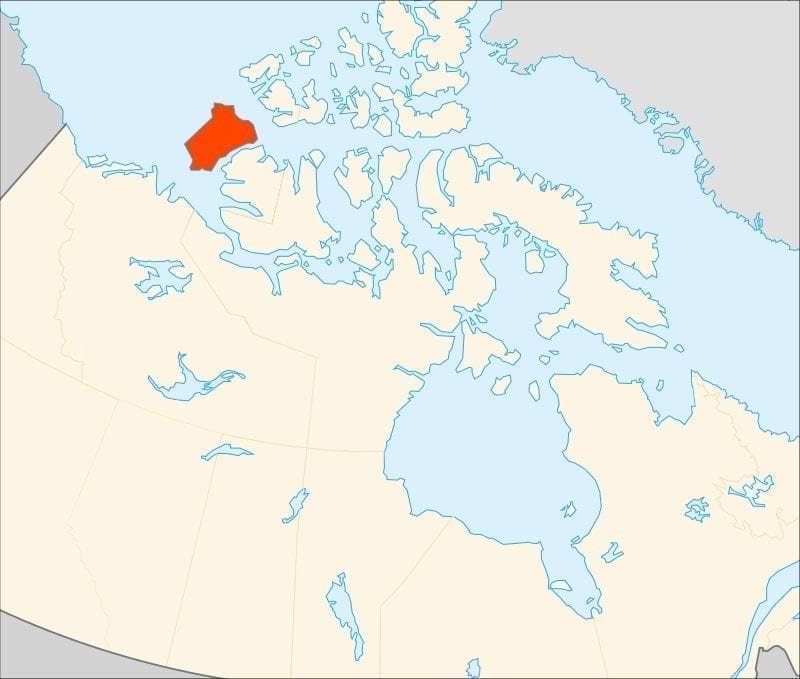
While a bit of activity has taken place 10 to 15 kilometres away from Sachs Harbour, there isn’t much going on near the community.
“Luckily, the community itself is not being impacted directly by these slumps at this point,” says Lewkowicz.
“We would need to know a lot more about the ground ice around Sachs Harbour, but I would say at this point, with this particular process, it does not look like the infrastructure there is at risk,” he said. He added that it’s difficult to predict what might happen in the future.
“The Arctic landscape is changing so much and so quickly that we don’t know what might arise in the long run.”
News/North reached out to elders and hunters in Sachs Harbour but was unable to schedule interviews with them before press time.
The majority of this activity was sparked by four unseasonably warm summers, in 1998, 2010, 2011 and 2012, according to the research.
“Permafrost is hidden," says Lewkowicz. "It’s below the ground’s surface. So, it’s been quite difficult to make direct links between climate change and permafrost change, apart from tracking temperatures.”
Compared to lessening year-round sea ice, which is plain to see via satellite and aerial imagery, there hasn’t been the same sort of dramatic effect on ice-rich landscapes—with a clear link to warmer temperatures—until researchers started looking into these landslides, happening across the Western Arctic.
“Fortunately, not every part of the Arctic is like the ice-rich parts of Banks Island or I think we would know much more that this had been happening.”
Lewkowicz credited much of the previous work on this subject to Yellowknife’s Steve Kokelj, a permafrost scientist with the GNWT.
Some of the recent research done by Kokelj and his team have linked the highest occurrences of this landslide activity to the prehistorical area covered by the Laurentide Ice Sheet.
As it retreated, this ice-rich ground—part of the bottom of the continental glacier—was left behind and had been preserved, to a degree, as permafrost for thousands of years by a relatively stable climate.