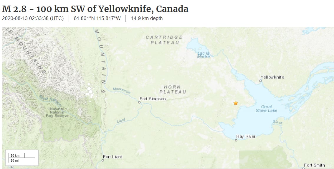
The United States Geological Survey (USGS) reports that a seismic "event" took place near Yellowknife around 8:33 p.m. Mountain Time on Wednesday, but Canadian earthquake experts say it didn't actually take place.
The event, which was identified by automatic detection from the USGS, was posted on the Canada Earthquakes and News Facebook page and shared more than 200 times.
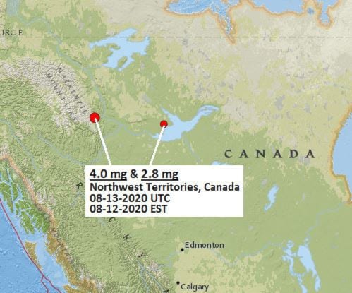
The event near Yellowknife was not to be confused with two other earthquakes that did take place in the southeastern Mackenzie Mountains outside of Wrigley earlier this week.
Andrew Schaeffer, an earthquake seismologist with the Geological Survey of Canada (GSC) based in Sidney, B.C., said the event was out of the ordinary because of its location, timing and depth. He added that it was not recorded and posted to the GSC website because analysts had not confirmed the automated wave form data.
"This (Yellowknife) event is likely later in the day than blasts would normally occur, and it is much deeper than any blast we would expect," Schaeffer stated in an email. "Combined with its time being a minute difference with the larger event in the Mackenzie Mountains, my expectation is that this (the occurrence near Yellowknife is) a spurious event and not actually real. The ones in the Mackenzie Mountains were indeed real."
The activity was located approximately 100 km southwest of Yellowknife, measuring at a magnitude 2.9 magnitude at a depth of 14.9 kilometre km.
Camille Brillon, another earthquake seismologist with the (GSC), said in an interview Friday that it's common for the American survey to post automatic detection data without analysts reviewing it – in this case from the Alaska Earthquake Center – to get information to the public quickly in the case of a bigger earthquake.
"In the event of a large earthquake, you want to notify people right away and that is why they (seismologists) don't always review everything right away," she said. "It is very likely it never even happened and will be removed from the database and that it is a false location.
"When dealing with an automated system, you will get false locations and that is why it is important for people to go through the wave form data to make sure they are real."
Mackenzie Mountains
Schaeffer said the Mackenzie Mountains are normally seismically active and regularly are the site of earthquake activity. The two reported earthquakes in the mountains earlier in the week definitely happened.
One Wednesday night at about 8:34 p.m. MT, a quake of 3.9 magnitude took place about 140 km southwest of Wrigley - located in the southeastern region of the Mackenzie Mountains.
The following morning, there was another quake, likely an aftershock of the first one, of 3.6 magnitude at about 8:38 a.m. MT.
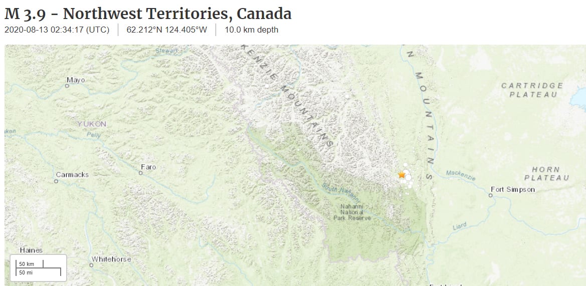
"Both of those are completely normal earthquakes because the Mackenzie Mountains are fairly seismically active as a young mountain range," Schaeffer said. "It is not uncommon to get three to 4.5 –and even 5 magnitude quakes – a number of times in the Mackenzie Mountains.
"Because of the low population density they are almost never felt," he said.